|
|
The 1973 eruption on the island of Heimaey is a classic example of the struggle between man and volcanoes. With a heroic effort the people of Iceland saved the town of Vestmannaeyjar and the country's most important fishing port.
Except where noted, all photographs are by the late Svienn Eirikksen, fire marshal of the town of Vestmannaeyjar. Photographs courtesy of the U.S. Geological Survey.
|
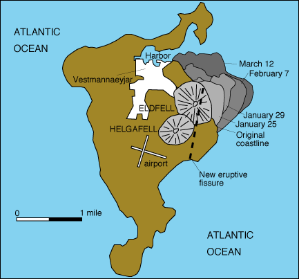
The island of Heimaey with the growth of the island in 1973, the location of the eruptive fissure, and the location of Eldfell, the 1973 cone. Modified from Williams and Moore, 1983.
|
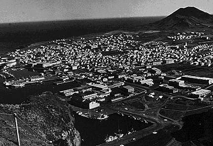
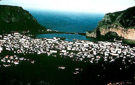
View of Heimaey before the eruption. The town of Vestmannaeyjar and the harbor are in the foreground. Helgafell, a prehistoric cone, is in the background on the right. From Williams and Moore, 1983.
|
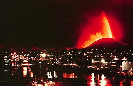
Eldfell ("fire mountain" in Icelandic) is a volcano on the island of Heimaey in the Vestmannaeyjar archipelago 15 miles (25 km) south of Iceland. In January of 1973, an eruption began along a 1.5 mile (2 km) long fissure not far from the center of the town of Vestmannaeyjar. The fissure extended across the entire island, producing a spectacular curtain of fire. Nearly all of the island's 5,300 residents were evacuated to the mainland.
|
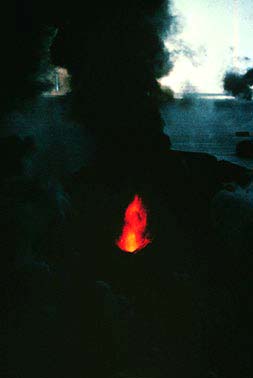
Within two days, activity became localized to a central vent and fire fountains constructed a cinder and spatter cone 350 feet (100 m) above sea level.
|
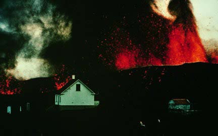
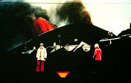
Strong winds blew tephra from the eruption and buried homes in the town Vestmannaeyjar.
|
Massive block lava flows threatened the town and the fishing port.
|
A submarine eruption cut the cable that supplied power from the mainland. The initial eruption rate was close to 130 cubic yards (100 cubic meters) per second. By the middle of April, the eruption rate had dropped to 7 cubic yards (5 cubic meters) per second. The eruption stopped in early July.
|
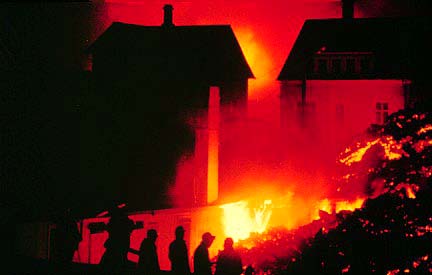
About 70 homes and farms were buried under tephra and 300 buildings were burned by fires or buried under lava flows.
|
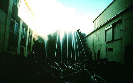
This eruption is famous because the Icelanders sprayed sea water on the lava to slow and stop its movement. It was the largest effort ever exerted to control volcanic activity. More than 19 miles (30 km) of pipe and 43 pumps were used to deliver sea water at rate up to 1.3 cubic yards (1 cubic meters) per second. By the end of the eruption 8 million cubic yards (6 million cubic meters) of water had been pumped onto the flows.
|
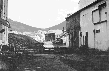
View in July 1974 of the same scene as above after removal of the lava. The building were restored. From Williams and Moore, 1983.
|
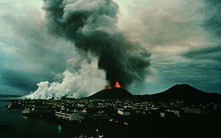
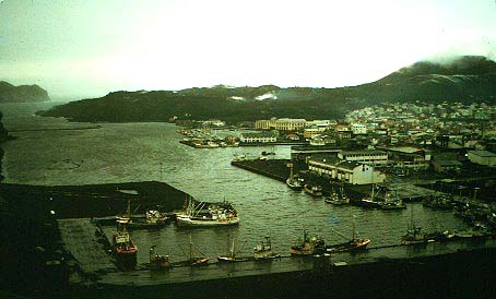
The town of Vestmannaeyjar and the harbor after the eruption. Eldfell and the 1973 lava flows are just beyond the town. Photograph by Robin Holcomb, U.S. Geological Survey.
|
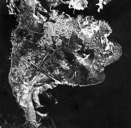
Not only did the tremendous efforts save the port they actually improved it. The residents returned to rebuild their town and even used the heat from the cooling lava to construct a district heating system. This vertical aerial photograph of the island shows the improved harbor, Helgafell and Eldfell cones, and the new land added to the island. Photograph by Iceland Geodetic Survey, September, 8, 1973. From Williams and Moore, 1983.
Grove, N., 1973, Volcano overwhelms an Icelandic village: National Geographic Magazine, v. 144, no. 1, p. 40-67.
Simkin, T., and Siebert, L., 1994, Volcanoes of the World: Geoscience Press, Tucson, Arizona, 349 p.
Thorarinsson, S., Steinthorsson, S., Einarsson, T., Kristmannsdottir, H., and Oskarsson, N., 1973, The eruption on Heimaey, Iceland: Nature, v. 241, no. 5389, p. 372-375.
Williams, R.S., and Moore, J.G., 1983, Man against volcano: The eruption on Heimaey, Vestmannaeyjar, Iceland: U.S. Geological Survey General Interest Publication, 27 p.
Images of Volcanoes
To VolcanoWorld