 |
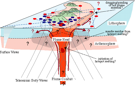
Schematic representation of
possible aspects of a plume beneath the Hawaiian hotspot and its interaction
with the lithosphere and asthenosphere beneath the Hawaiian Swell.
SWELL (Seismic Wave Exploration in the Lower Lithosphere) |
 |
Источник |
 |
|
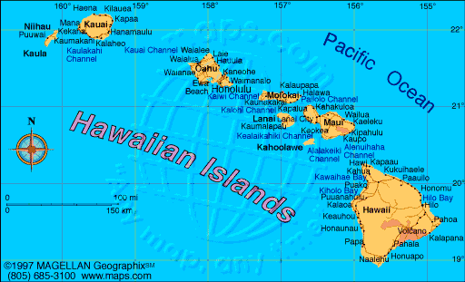
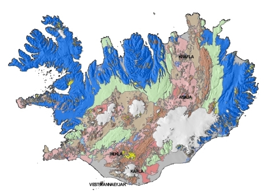
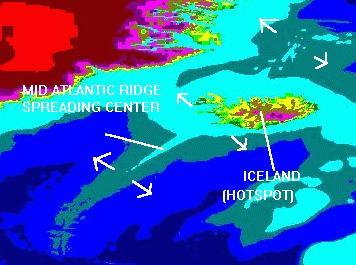
Исландия
 |
 |
 |
 |
 |
 |
Катла |
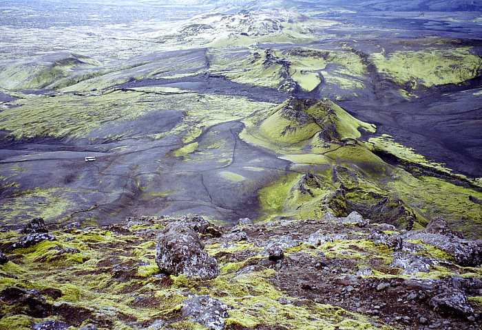 |
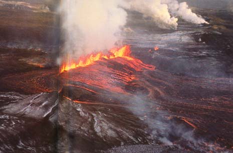
Извержение 1783. Трещина Лаки. Длина разлома 25 км. |
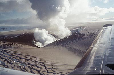 |
The Gjalp vent 1998, ERZ, which occurs in a chain including
Grimsvotn and Bardabunga centres. The ice of the Vatnajokull can be see
fracturing as it flows inwards towards the melt zone round the vent. The ice
is covered in a layer of ash. Photo: Scientific Inst., Uni. of Iceland |
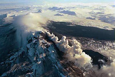 |
Mt Hekla in recent eruption, view north along the rift. Note the two fresh black lava flows to the right. Elongate mountain ridges in distance are apparently due to subglacial lava emerging along rifts in the Pleistocene glacial time and being confined by ice and prevented from spreading laterally. Photo: Thor Thordarson, Volcanic Institute of Iceland, 16-Feb-1991 |
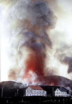
| вулкан Эльдфель (Eldfell).
1973
|
 |
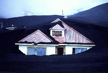 |
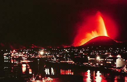
The small island of Heimaey, off the south coast of Iceland
was involved in an eruption in 1973. The town of Vestmannaeyjar and its
5,000 inhabitants was evacuated. Over the course of almost 5 months of
continuous volcanic activity, the islanders watched as the eastern part of
their town was engulfed in thick ash and lava deposits. This photograph was
taken in April of 1973 and it shows one of the houses in the eastern suburbs
completely covered in ash. Icelandic geologists kept a careful watch on this
small volcano, monitoring the gases emitted and the ejecta produced to try
to predict the outcome of the eruption. The volcano (Eldfell), finally
stopped in May, 1973, and in the subsequent 20 plus years the island has
more or less returned to normal. |
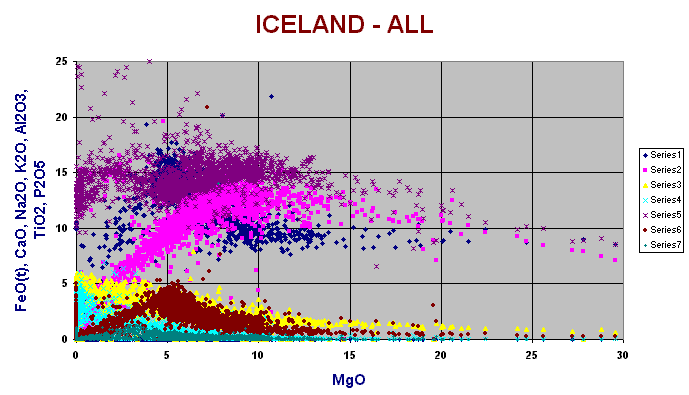 |
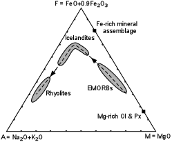
Variation diagram for all Icelandic rocks, (N = 3722). These
range from depleted high degree melt magnesian basalts to rhyolites and
alkali basalts to trachytes. Note wide range in K especially. Rocks with high alumina (20 - 30% are mainly from gabbroic intrusions, eg the Krisuvik gabbro in the Reykjanes Peninsula. Note distinctive ferro-basalts with high TiO2 (5%) |
 |
 |
Аномалии по S-волнам под Исландией. |
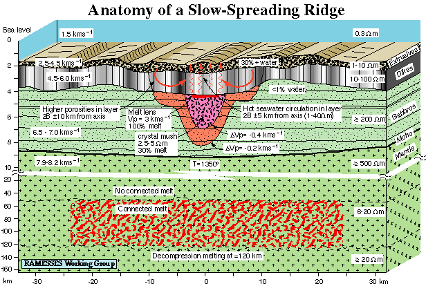 |
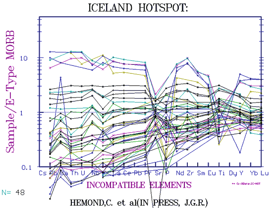
Combined interpretation based on data from seismic,
controlled-source electromagnetic, and magnetotelluric experiments. Seafloor bathymetry and seismic layer boundaries are quantitatively accurate based on swath bathymetry measurements and seismic modelling. Similarly, estimates of electrical resistivity, porosity, melt content, and temperature are quantitative estimates based on modelling and interpretation. Note the 10:1 break in scale at 10 km depth |